Trimble Workflow Solutions for a Winning Drive at CCF Victoria Golf Day

We Love When a Plan Comes Together!

At SITECH, we know how exciting it is when everything clicks into place. That’s exactly what happened when we applied Trimble Workflow Solutions to add a bit of fun to the Longest Drive Challenge at the CCF Victoria Golf Day, held at Spring Valley Golf Club.

By integrating cutting-edge technology, we made it work seamlessly, enabling teams to collaborate, work smarter, and deliver outstanding results.

Here’s a breakdown of how the full workflow came together at the event:

Step 1: Reality Capture with Trimble Stratus

Our journey began with Trimble Stratus, a powerful reality capture tool that uses drones to gather high-quality data from the course. During the event, a drone was flown over the golf course, capturing both a point cloud and ortho photos. These images are not just pretty pictures—they represent the course in stunning detail. The drone flight captures precise information, including terrain elevations and structures, which is then sent to Trimble Stratus, powered by Propeller. This cloud-based software processes the raw drone data, seamlessly stitching together the images and generating a high-fidelity point cloud that offers a comprehensive 3D representation of the golf course environment.

Step 2: Export to Trimble Connect

Once the data was processed, it was time to export it into Trimble Connect, our collaborative cloud platform. Trimble Connect serves as a central hub for all project data, keeping everything organised in one accessible location. This ensures that every team member—whether working on-site or remotely—has easy access to the most up-to-date information. The collaboration is streamlined, allowing for better communication and more efficient decision-making.

Reality Capture with Trimble Stratus

Step 3: Import into SketchUp

With the data securely in Trimble Connect, we moved on to the next step: creating detailed 3D models. The processed point cloud was imported into SketchUp, where our designers and engineers could begin the modelling process. Using SketchUp’s intuitive interface, they could refine the models and integrate detailed elements of the golf course and reference markers for the long drive challenge. We even threw in an overpass model to give participants an idea of what it could look like on their construction site. SketchUp’s easy-to-use tools allowed for rapid prototyping, ensuring that the final design would be accurate and ready for integration with other tools.

Step 4: Coordinate Model in Trimble Business Centre

Next, we brought the 3D model into Trimble Business Centre (TBC) to ensure that all data was properly coordinated and aligned. TBC is designed to handle construction-specific data, so it made sense to use this tool to finalise the project’s data alignment. Here, we could easily check for inconsistencies or errors in the model and ensure that everything was ready for field use. Once the coordination was complete, the model was exported back into Trimble Connect in the appropriate format for seamless access by all field teams.

Trimble SiteVison - longest hole CCF 2025

Step 5: Visualise Your Model Using Augmented Reality

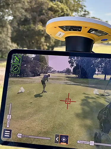
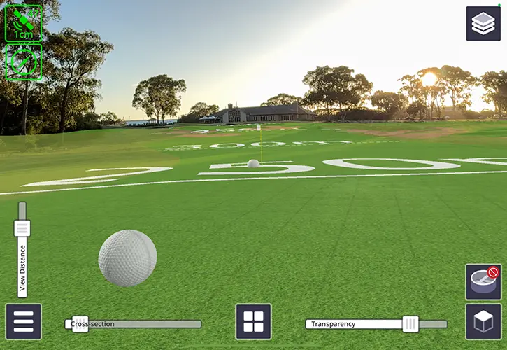
One of the most exciting aspects of the project was the final step: using Trimble SiteVision to visualise the 3D model in augmented reality (AR). This cutting-edge AR technology allows users to view the 3D model overlaid onto the real-world environment. At the golf day, we used SiteVision to capture the Longest Drive Challenge, bringing the best drives from previous groups to life in an immersive, interactive way. Using the Lidar measure function, we captured all the drives, well those which stayed on the fairway at least. Players and spectators alike could view the trajectory of the shots through the AR system, which not only made the event more fun but also showcased the incredible capabilities of this technology.

The Winner: Tavis Lavell from MNG

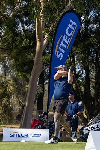
A huge congratulations to Tavis Lavell from MNG, who won the Longest Drive Challenge with an incredible shot of 257.6 meters! Tavis’s impressive drive certainly made an impact, and we were thrilled to capture the moment using our augmented reality system. What better way to visualise his incredible shot than with a 3D model that shows the flight path and distance in real-time?

CCF Longest Drive Winner Tavis Lavell - 2025

Closing Thoughts

From drone-based reality capture to 3D modelling and visualising models in the field using augmented reality, this connected workflow exemplifies how technology can revolutionise the construction industry. By integrating tools like Trimble Stratus, Trimble Connect, SketchUp, Trimble Business Centre, and Trimble SiteVision, we’ve made collaboration faster, easier, and more accessible than ever before. These technologies help teams work smarter, not harder, by streamlining workflows and enhancing communication across every stage of a project.

We’re excited to see where the future of construction technology will take us, and we’re proud to help our clients harness these tools for success. Whether you’re working on a major construction project or organising a fun event, SITECH and Trimble Technology can bring your vision to life with precision, efficiency, and creativity.

SITECH CCF Longest Hole 2025

If you’d like to know more about Trimble Workflow Solutions, get in touch