TRIMBLE BUSINESS CENTER

MANAGE DATA & CREATE DESIGNS FOR YOUR PROJECTS FROM START TO END

TBCANZ.com is your dedicated hub for Trimble Business Center in Australia and New Zealand. Specifically tailored for surveying, construction, and civil engineering professionals, TBCANZ provides a comprehensive software solution. It empowers users to process, analyse, and manage geospatial data from diverse surveying and mapping instruments.

With robust tools for data editing, visualisation, and reporting, TBCANZ streamlines project workflows, ensures accurate data analysis, and facilitates informed decision-making throughout the project lifecycle.

Trimble Business Center
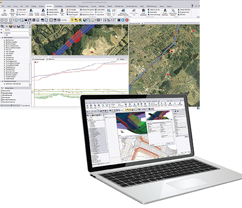
  • Trimble Business Center offers robust tools for creating accurate 3D constructible models, enhancing decision-making and efficiency.
  • Seamlessly manage data between the office, Trimble Site Positioning Systems, and machine control technology to reduce drive time.
  • Rapidly create, edit, and draft reports and plots, minimising rework with clean, up-to-date data.
  • Win more bids with detailed earthwork and construction takeoffs, and optimise site earthworks to increase profit.
  • Compatible with various Trimble software and control systems, ensuring seamless integration and enhanced functionality across projects.

Benefits of Trimble Business Center

Leverage one software environment that delivers the flexibility and capabilities needed for surveyors’ diverse project requirements.

Powerful workflows with TBC

Powerful workflows for superior results

From the industry-leading GNSS baseline processor to dynamic surfaces, point cloud classification and feature extraction, optimize your data and deliverables.

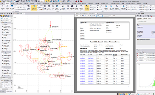
View & adjust raw data in one software

Eliminate unnecessary data exports, correct field blunders, reduce rework and ensure data traceability in a single application.

View & adjust raw data with TBC

DATA CONFIDENCE

TRIMBLE EARTHWORKS FOR GRADERS

Work with data, not coordinates

Review and adjust metadata like rod heights and vector quality, and then refine your raw observations with a least squares routine or GNSS post-processing.

DATA INTEGRATION

TRIMBLE GROUNDWORKS

Support all survey sensors

Bring your GNSS, total station, digital level, terrestrial scan, UAV, mobile mapping and machine control data into one project environment.

INTEROPERABILITY

TRIMBLE EARTHWORKS FOR SOIL COMPACTORS

Report & share results

Work across standard industry hardware formats. Then, connect your project to software providers such as ESRI, Autodesk, Bentley and more.

ROBUST DELIVERABLES

TRIMBLE ROADING SOLUTIONS

Report, create, export & more

Start and stay in TBC with options like adjustment reports, digital surfaces, classified point cloud regions, constructible corridors and third-party exports.

Reach out & lets talk!

Fill out the form below and we’ll be in contact, or reach out directly on 1800 748 324